The 12 least-populated states in the U.S., ranging from Wyoming with 586,485 residents to West Virginia with 1,766,110, provide key insights into demographic trends.
States like Delaware and Montana have shown notable growth rates of over 5% in recent years, while others, like West Virginia and Hawaii, have experienced population declines.
This analysis examines their population changes, growth rates, and contributions to the nation’s demographic and economic landscape.
Rank
State
Population (Most Recent)
Growth Rate (%)
% of the Total US Population
Population Density (per sq mile)
1
Wyoming
586,485
0.42
0.17
6
2
Vermont
647,818
0.06
0.19
70
3
Alaska
733,536
0.02
0.22
1
4
North Dakota
788,940
0.64
0.23
11
5
South Dakota
928,767
1.03
0.28
12
6
Delaware
1,044,320
1.21
0.31
536
7
Rhode Island
1,098,080
0.19
0.33
1,062
8
Montana
1,142,750
0.88
0.34
8
9
Maine
1,402,110
0.46
0.42
45
10
New Hampshire
1,405,100
0.22
0.42
157
11
Hawaii
1,430,880
-0.30
0.43
223
12
West Virginia
1,766,110
-0.22
0.53
73
Table of Contents
Toggle1. Wyoming
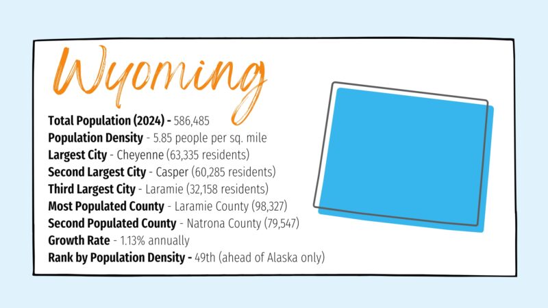
Wyoming, the least populated U.S. state, has a population of 586,485 and a density of just 5.85 people per square mile.
Over half the population resides in its 13 largest municipalities, with Cheyenne as the largest city.
While sparsely populated, the state sees modest growth, ranking 15th in the nation for growth rate.
2. Vermont
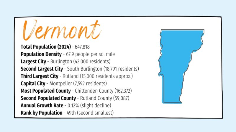
Vermont, the 49th most populous state in the U.S., has a population of 647,818 and a density of 67.9 people per square mile, ranking 30th in density nationwide.
Its largest city, Burlington, has 42,000 residents, while the capital, Montpelier, is only the fifth largest city.
Despite its modest population, Vermont boasts a unique charm as the only state without a building taller than 124 feet and continues to maintain its rural character amidst a slight population decline.
3. Alaska
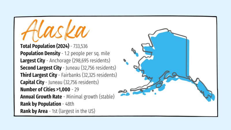
Alaska, the 48th most populous state, is by far the largest state in the U.S. with a surface area of 665,384 square miles and a population density of just 1.2 people per square mile, making it the most sparsely populated state.
Anchorage is its largest city, home to nearly 300,000 people, followed by Juneau and Fairbanks, both with populations exceeding 32,000.
Despite its size, Alaska remains primarily rural with only 29 cities exceeding 1,000 residents.
4. North Dakota
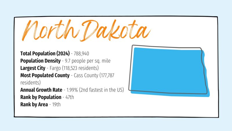
North Dakota, the 47th most populous state in the U.S., has a population of 788,940 and a low density of 9.7 people per square mile, making it one of the most sparsely populated states.
Fargo, with a population of 118,523, is its largest city, while Cass County, housing 177,787 residents, is the most populated county.
Despite its rural nature, the state boasts a significant annual growth rate of 1.99%, ranking second-fastest nationally.
5. South Dakota
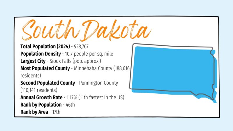
South Dakota, the 46th most populous state, has a population of 928,767 and a density of 10.7 people per square mile, ranking 46th in population density.
Its largest city, Sioux Falls, and its most populated counties, Minnehaha and Pennington, drive much of its growth.
While rural areas have experienced declines due to “rural flight,” urban areas and counties like Lincoln are experiencing significant growth, showcasing a shifting population dynamic within the state.
6. Delaware
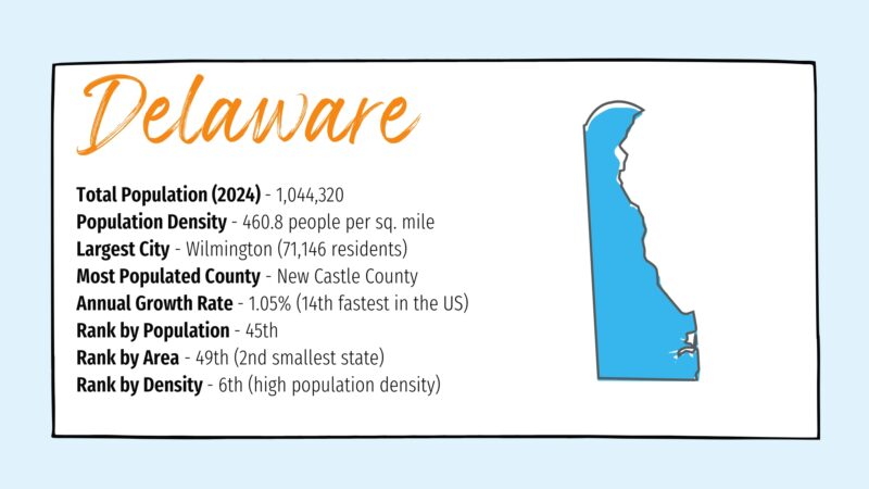
Delaware, the 45th most populous state, has a population of 1,044,320 and a high density of 460.8 people per square mile, making it the 6th most densely populated state in the U.S.
The largest city, Wilmington, houses 71,146 residents, and most of the population is concentrated in New Castle County.
Despite being the second smallest state by area, Delaware is experiencing steady growth with an annual rate of 1.05%.
7. Rhode Island
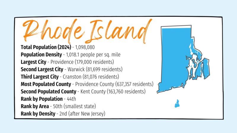
Rhode Island, the smallest U.S. state by area, has a population of 1,098,080 and a density of 1,018.1 people per square mile, making it the second most densely populated state but still among the least populated.
Providence, the largest city, is home to 179,000 residents, followed by Warwick and Cranston.
The state’s population is concentrated along a corridor extending from Providence to Woonsocket, with Providence County as the most populous.
Despite its size, Rhode Island maintains a robust population and ranks 44th in the nation by population.
8. Montana
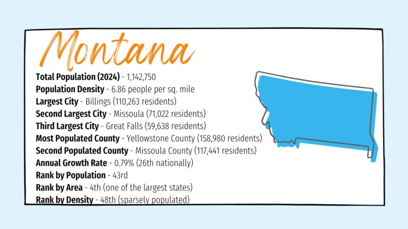
Montana, known as Big Sky Country, has a population of 1,142,750 with a sparse density of 6.86 people per square mile, ranking 48th in population density in the U.S.
While the state is the 4th largest by area, its geography limits large-scale development.
Billings is the largest city with 110,263 residents, followed by Missoula and Great Falls.
Population growth is primarily centered in urban areas like Yellowstone and Missoula counties, while rural regions face gradual declines.
9. Maine
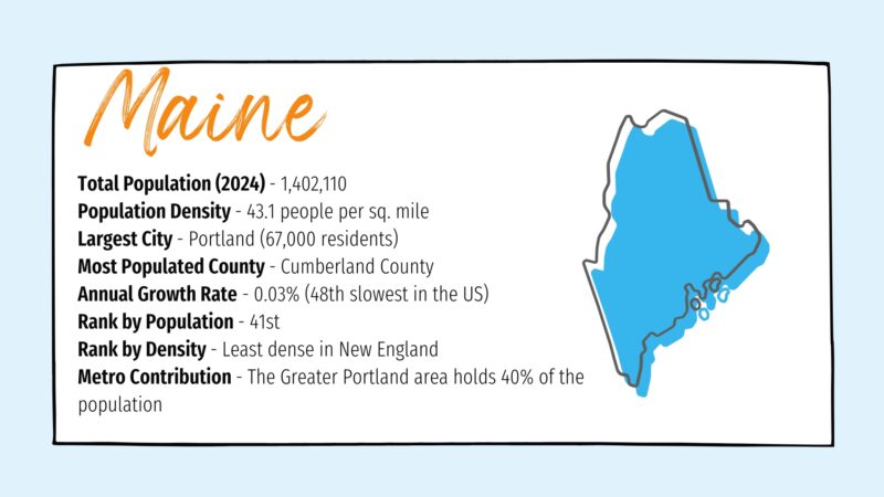
Maine, the 41st most populous U.S. state, has a population of 1,402,110 and a density of 43.1 people per square mile, making it the least densely populated state in New England and the eastern seaboard.
The largest city is Portland with 67,000 residents, and the most populated county is Cumberland County.
Despite its natural beauty and cultural fame, Maine’s population growth is one of the slowest in the nation, with much of the state consisting of uninhabited interior lands.
10. New Hampshire
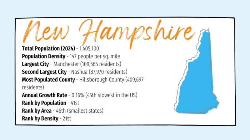
New Hampshire, one of the original thirteen colonies, has a population of 1,405,100 and a density of 147 people per square mile, ranking 21st in population density.
Manchester, the largest city, is home to over 109,000 residents, followed by Nashua with nearly 88,000.
Hillsborough County is the most populous in the state, while the northern third remains sparsely populated, facing economic challenges but maintaining its appeal as a tourist destination.
11. Hawaii
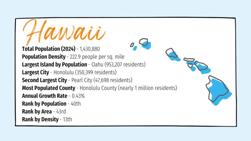
Hawaii, the 40th most populous U.S. state, has a population of 1,430,880 and a density of 222.9 people per square mile, ranking 13th in population density.
The island of Oahu dominates with 953,207 residents, while Honolulu, the largest city, is home to 350,399 people.
With its unique geography and eight major islands, Hawaii combines a small land area with a relatively high population density compared to other states.
12. West Virginia Population and Density Overview
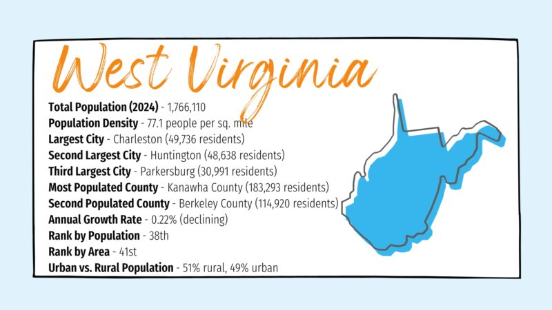
West Virginia, the 38th most populous state, has a population of 1,766,110 and a density of 77.1 people per square mile, making it 29th in population density.
Charleston, the state capital, is the largest city with 49,736 residents, followed by Huntington and Parkersburg.
The state’s population has seen slow growth or decline since the 1950s, with a majority of residents living in rural areas.
Kanawha and Berkeley counties are the most populated regions, reflecting West Virginia’s small and evenly distributed population centers.
Related Posts:
- San Francisco’s Population Loss Among Biggest in the US
- New Quebec Gold Discovery May Be the Biggest Canada…
- One in Four Teens Use ChatGPT for Homework - Experts…
- One Weight Loss Strategy Is Far More Effective Than…
- 15% of People Live Near Coasts – And the Number Keeps Rising
- Number of Federal Employees of US in 2025 - How Many…


