
When people talk about the biggest cities on Earth, the conversation usually circles Tokyo, Shanghai, and maybe New York. But the truth sits far from the headlines, and even farther from the familiar outline of any map most of us have ever looked at.
Hidden deep in the mountains of southwest China lies Chongqing, a city so massive and so unlike anything in the Western urban vocabulary that you almost feel embarrassed you didn’t know it existed sooner.
I remember the first time someone mentioned Chongqing to me:
“Over 32 million people live there,” they said.
I thought they were joking. How could a city that large stay invisible?
But as soon as you begin to understand how Chongqing works, how it stretches, climbs, folds, and breathes, you realize why it tends to slip out of the global conversation.
It isn’t just unusual. It breaks the mold of what we think a city is allowed to be.
A City Built Where Cities Shouldn’t Exist
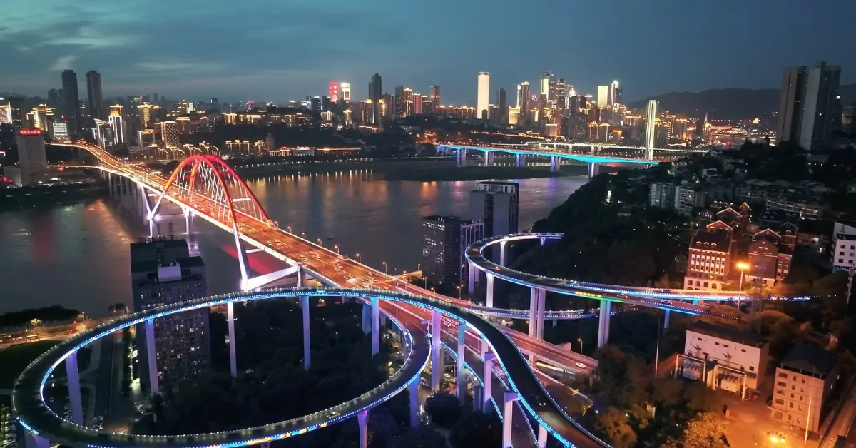
Chongqing sits at the meeting point of two enormous rivers, the Yangtze and the Jialing. But what defines the city isn’t water, it’s verticality. The land rises and falls in cliffs and ravines, with entire neighborhoods perched on ridges like architectural barnacles.
When you look at a map, nothing seems too far. But the map lies.
What appears as a five-minute walk may in reality be a lung-burning climb of twenty stories. The “ground floor” of one building is often the roof of another. Streets float.
Staircases disappear into hills. And the metro system cuts straight through holes in skyscrapers as if that were the most normal engineering decision in the world.
The first time I saw video footage of trains sliding through a residential building at Liziba Station, I genuinely had to freeze the frame. This wasn’t CGI. This was just daily life.
Oliver Wainwright from The Guardian described Chongqing perfectly:
Navigating it feels like walking through Inception, if Inception had a metro card.
And it fits. The city doesn’t just sprawl; it stacks.
The Map Problem: When a City Outgrows Its Definition
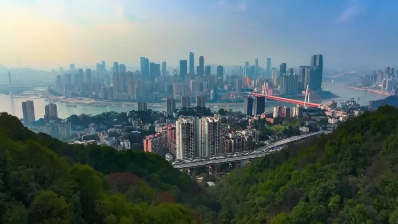
The biggest challenge with Chongqing isn’t its size, although, yes, the municipality covers 82,000 square kilometers, an area larger than Austria. The real challenge is conceptual.
Chongqing is officially classified as a provincial-level municipality, meaning it includes both dense urban districts and far-reaching rural counties.
Critics argue this inflates the population count. But they miss an important point: even just the dense urban core contains over 20 million residents packed in an environment more intense than Manhattan or Seoul.
You can’t dismiss that as paperwork.
That’s a genuine megacity.
But here’s where the story gets stranger: despite being, by many measures, the largest city on Earth, Chongqing barely exists in Western public awareness.
Ask 100 people in Europe or North America about it, and most won’t even be able to place it on a map.
That disconnect speaks volumes, not about Chongqing’s insignificance, but about our narrow definition of what a city “should” look like.
Living in Layers: Commuting in Chongqing
View this post on Instagram
One photographer, Jackson Lu, unintentionally gave the world a masterclass in Chongqing urbanism when he filmed his morning commute.
The video, now viewed more than 37 million times, looks like a parkour challenge disguised as daily life:
- Climbing down 18 floors because his building has no elevator
- Crossing a skybridge located on the 12th floor
- Boarding a metro line that punches through the middle of a tower
- Arriving at his office, technically on the 22nd floor, but accessible from street level
What struck me wasn’t the spectacle. It was how normal he made it look. For him, this wasn’t extraordinary. This was Tuesday.
Infrastructure as Performance Art
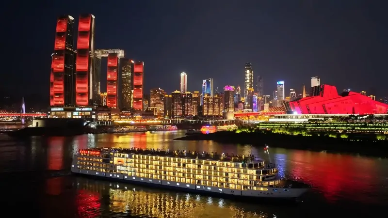
Chongqing is a rare place where public infrastructure becomes a kind of theater.
The Liziba Station, once controversial, is now an iconic tourist spot complete with a selfie sign encouraging visitors to “check in.” The city has effectively turned its chaotic geometry into a brand.
Everywhere you look, bridges jump across valleys, roads sit suspended above rooftops, and cable cars glide over entire districts. If cities had personalities, Chongqing’s would be unapologetically dramatic.
But behind the spectacle is necessity. The city was forced to build upward and inward because the land offered no alternative. Geography dictated the blueprint. Humans adapted.
Why Chongqing Stayed in the Shadows
@olivertree The biggest city in the world that you never heard of @Dylan Page ♬ original sound – Oliver Tree
You would think a megacity of 32 million people would command global attention, but Chongqing never really stood a chance. It defies almost every Western expectation of what cities look like:
- It isn’t flat.
- It isn’t radial.
- It isn’t organized around a single center.
- It isn’t visually intuitive on a standard two-dimensional map.
In a world used to grids, New York, Chicago, Paris, and Chongqing look chaotic. But its chaos is deliberate.
Engineers and urban planners learned to cooperate with the terrain instead of bulldozing it. That philosophy, ironically, might be the future of city planning.
As sea levels rise and global urban populations grow denser, Chongqing’s layered, adaptive design begins to look less strange and more like a blueprint for survival.
The City That Forces the World to Look Up
Whether Chongqing will ever get the recognition it deserves remains unclear. But the lesson it offers is unmistakable: cities don’t have to be flat to function. They can climb mountains.
They can weave through buildings. They can stretch into the air.
Chongqing stands as a reminder that not all urban futures will be polished, symmetrical, or predictable. Some will be messy, improvised, and vertical.
Some will make you dizzy. And some will be unforgettable precisely because they challenge the idea of what a city can be.
I used to think of cities as something we build. But Chongqing made me rethink that.
Some cities don’t get built.
They grow into the only shape that the land will allow.
And once you’ve seen Chongqing, even in a photo, you’ll never look at a flat map the same way again.