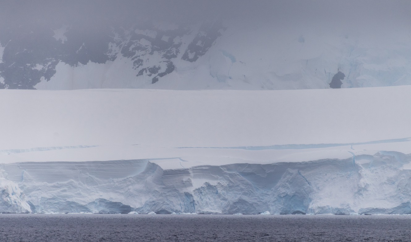
A new study warns that the West Antarctic Ice Sheet may need very little additional ocean warming to enter a lasting collapse that would eventually raise global sea levels by more than 4 meters, or about 13 feet.
The finding comes from a modeling paper published in Communications Earth & Environment. The authors analyzed the last 800,000 years of Antarctic ice history and found that West Antarctica is highly sensitive to small temperature changes in the deep ocean near the ice sheet.
The results require careful reading. The paper does not state that a 4-meter sea-level rise will happen over the next decade or even within this century. The warning focuses on a tipping point. Once a certain level of retreat begins, the ice sheet could keep shrinking for centuries or millennia, even if warming later slows down.
This potential for irreversible loss is exactly why the study is drawing attention. The resulting rise in sea levels would arrive slowly by human standards, but the critical choice points could come much earlier.
What The Study Found
The study found that the West Antarctic Ice Sheet can shift from a stable state to a long-term retreat when deep ocean temperatures near Antarctica rise by just 0 to 0.25 degrees Celsius above present levels.
That number does not refer to the global average air temperatures that dominate climate headlines. It refers specifically to deep ocean water around West Antarctica, where warm currents can reach the underside of floating ice shelves.
These ice shelves act as brakes. They do not sit entirely on land; instead, they float at the edge of the ice sheet and slow down the movement of the glaciers behind them. When warmer water thins these shelves from below, the glaciers behind them can accelerate toward the ocean.
The paper states that a West Antarctic collapse would contribute more than 4 meters of global sea-level rise once it reaches a long-term equilibrium. The authors also note that the present-day ice sheet may already be in, or close to, an overshoot state.
Why West Antarctica Is So Vulnerable?
West Antarctica has a structural vulnerability. Much of its ice rests on bedrock that sits below sea level. In many areas, this bed slopes downward as it goes further inland, a shape that can make retreat self-reinforcing.
As the grounding line moves back into deeper areas, thicker ice reaches the ocean. Thicker ice discharges a greater volume of ice into the sea, which can then push the grounding line even farther back.
Scientists call this process marine ice sheet instability. In plain terms, the ice sheet can lose its grip entirely once warm water removes enough support at the edges.
The study identifies the Amundsen Sea and Weddell Sea sectors as the key areas where tipping begins in the model. The Amundsen Sea region includes the Thwaites and Pine Island glaciers, which already receive close scientific attention due to observed grounding-line retreat and ocean-driven melting.
The Damage A 4-Meter Sea Rise Would Bring To Coastlines
A 4-meter rise in sea level would take a long time to develop, but the consequences would reshape life far beyond beaches and waterfront homes. It would change how coastal cities manage housing, roads, ports, drainage, drinking water, insurance, and emergency planning.
The impact would vary by location. A city built on sinking land would face worse flooding than a rocky coastline at higher elevation. A flat delta with extensive farmland would face different damage than a tourist island or a major port. Even with those differences, a rise of about 13 feet would put many low-lying coastal areas under pressure that current infrastructure was never built to handle.
Low-Lying Islands Face The Highest Risk
Small island nations and low-lying island communities sit closest to the danger. A 4-meter sea rise threatens homes, schools, roads, airports, power systems, cemeteries, and freshwater supplies.
For many islands, water problems would begin long before land disappears under the sea. Saltwater can move into groundwater and damage the freshwater lens that communities depend on for drinking. This can make daily life difficult even while homes and streets remain above water.
River Deltas Would Be Hit From Several Sides
River deltas are among the most exposed places in the world because they are flat, crowded, and directly shaped by water systems. The Nile Delta, Mekong Delta, Ganges-Brahmaputra Delta, and Mississippi Delta are clear examples.
A higher sea would push saltwater farther into rivers and groundwater, damage farmland, increase erosion, and make storms more destructive. In delta regions, the risk is not just coastal flooding; food production, drinking water, roads, ports, and housing would all come under strain at the same time.
Coastal Megacities Would Face Repeated Flooding
Major coastal cities would need costly protection. Miami, New Orleans, New York, Shanghai, Mumbai, Jakarta, Lagos, Alexandria, Bangkok, and parts of Tokyo Bay all have low-lying districts where several meters of sea rise would drastically increase flood risks.
Some neighborhoods could be defended with seawalls, flood gates, pumps, raised roads, and improved drainage. Other areas would be harder to protect because the land is flat, crowded, sinking, or highly exposed to storm surge. In those places, officials would eventually face decisions about moving people, utilities, and public services away from the most exposed zones.
Storm Damage Would Reach Deeper Inland
Higher seas make coastal storms more damaging because storm surges begin from a higher baseline water level. A hurricane, cyclone, or winter storm could push water much farther into streets, tunnels, subway systems, ports, and low-lying housing areas.
Flood zones would expand. Areas that seem outside major flood risk today could become vulnerable later, affecting insurance costs, property values, evacuation routes, emergency shelters, and local budgets.
Ports And Trade Would Face Disruption
Ports are built at the edge of the water, making them directly exposed to a higher sea. A 4-meter rise would threaten docks, warehouses, cranes, fuel storage, access roads, rail links, and customs facilities.
Port damage would not stay local. Ports move food, fuel, cars, construction materials, medical supplies, and consumer goods. Long shutdowns in major port regions could raise costs and slow supply chains far inland.
Fresh Water And Farmland Would Become Harder To Protect
Sea-level rise can push saltwater into rivers, wells, wetlands, and coastal aquifers. This creates immediate problems for drinking water, irrigation, and farming.
Coastal farmland would face saltier soil and greater flood risk. Cities would need to spend more on pumps, barriers, drainage, and water treatment, while poorer regions would have the hardest time paying for that protection.
Roads, Power And Wastewater Systems Would Need Major Work
Many coastal roads, bridges, rail lines, airports, hospitals, power stations, and wastewater systems were built close to sea level. A 4-meter rise would expose them to repeated flooding and saltwater damage.
Some systems could be raised or defended, while others would need to be moved entirely. The cost would build year after year as repairs, insurance claims, and public works projects become a regular part of coastal management.
Poorer Communities Would Have Fewer Options
The people most at risk are not just those closest to the water. The highest risk falls on communities with low incomes, weaker infrastructure, limited insurance, and fewer options to move.
Wealthier areas can pay for barriers, pumps, raised homes, and legal help. Lower-income communities often recover more slowly after floods and have less influence when governments decide which areas get protection first.
The Risk Extends Beyond The Shoreline
We previously covered how coastal exposure already shapes population risk in our report on how people live near coasts. A 4-meter rise linked to West Antarctic ice loss would raise that risk on a much larger scale.
The damage would reach housing, food, water, transport, insurance, public budgets, and migration. The full rise would take a long time, but cities and infrastructure are built to last for decades, which is why planning becomes much harder when action is delayed.
The Timeline Is The Hard Part
The most important distinction is between the trigger and the final outcome.
The trigger could happen with a small amount of additional deep-ocean warming, but the final sea-level rise would unfold over centuries to millennia. That means people alive today would not see the full 4 meters, but decisions made now determine whether later generations inherit that path.
The paper also says the process might not yet be inevitable. The authors describe the current situation as a period of limited borrowed time, where better observations and lower future warming could still affect the path.
SpaceDaily, in a June 2026 report on the study, framed the finding in similar terms: the threshold may be close, the full outcome would be slow, and the paper should be treated as one modeling study rather than final certainty.
What The Study Does Not Prove?
The study is important, but it remains a model result. Ice-sheet models depend on choices regarding ocean forcing, ice physics, bedrock shape, and feedbacks between ice, water, and climate.
The authors acknowledge that some feedbacks are still difficult to capture. Other research groups may estimate different thresholds or timelines, which is normal in a field where direct observations cover only a short part of the ice-sheet story.
The paper adds a serious warning to the evidence base, but it does not create a precise date for collapse. It does not say all coastal cities face 4 meters of rise in the near future. It does say the West Antarctic system may be closer to a dangerous threshold than many people assume.
Scientists Looked Back 800,000 Years
Modern satellite records cover only a few decades, which is too short to judge how a massive ice sheet behaves over full climate cycles.
The researchers used simulations covering the last 800,000 years, including repeated glacial and interglacial periods. This longer view helps compare West Antarctic behavior under warmer and cooler historical conditions.
In the model, the West Antarctic Ice Sheet repeatedly showed tipping behavior during warmer periods. East Antarctica appeared much more stable in those simulations, at least under the ocean warming levels examined.
The Bottom Line
The new West Antarctic Ice Sheet study warns that a collapse capable of raising seas by more than 4 meters could begin with little additional warming in the deep ocean around Antarctica.
This does not mean 4 meters of sea-level rise is about to arrive. It means the ice sheet may have a tipping point close to present conditions, and the consequence of crossing it would unfold over centuries or longer.
The practical takeaway is clear: West Antarctica remains one of the biggest long-term uncertainties in sea-level planning. The full outcome would be slow, but the threshold that starts it may be much closer than the final water level makes it seem.
On the other side of the planet – Arctic Ocean reaches chemical tipping point as melting sea ice alters nutrient supply.