
Los Angeles occupies a remarkable piece of Southern California. The city reaches from the Pacific coast into the San Fernando Valley and climbs from low coastal ground to mountains more than 5,000 feet above sea level.
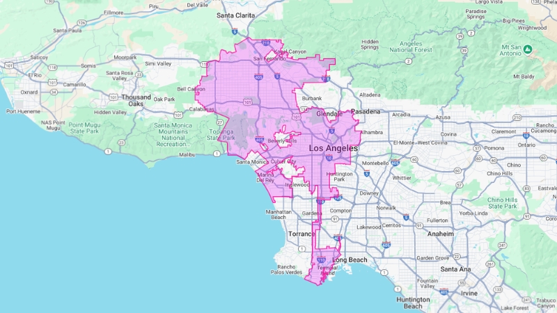
Its map does not resemble a neat circle or square. Long corridors connect distant sections of the city. Independent municipalities interrupt its boundaries. Mountain ranges divide neighborhoods that may appear close on a map but remain far apart by road.
Los Angeles is the largest city in the state of California by population and the second-largest city in the United States. Sacramento, not Los Angeles, is the state capital.
The Hollywood Sign stands on Mount Lee in the Hollywood Hills. Hollywood itself is a neighborhood inside Los Angeles rather than a separate city. Beverly Hills, West Hollywood, Santa Monica, Culver City and Inglewood are independent cities surrounded by or located beside Los Angeles.
Now, let’s see what are those most attractive places around LA, think of this as an interactive map or a guide. You can use it if you are planning to visit LA.
Key Insights
- Los Angeles covers 502.7 square miles, including 468.7 square miles of land.
- The official 2020 Census counted 3,898,747 residents.
- The latest completed Census estimate placed the city population near 3.88 million.
- Mount Lukens is the highest point within the city at approximately 5,074 feet.
- The Los Angeles River runs for about 51 miles before reaching the Pacific Ocean.
- Los Angeles contains 15 City Council districts and almost 100 neighborhood councils.
- The city will host the Summer Olympic and Paralympic Games in 2028.
How Los Angeles Became Such a Large City?
The modern city stands on land first inhabited by the Tongva people. Yaanga, one of the principal Tongva settlements in the basin, was located near present-day Downtown Los Angeles.
Spanish authorities established El Pueblo de la Reina de los Ángeles on September 4, 1781. The settlement began with 44 residents known as Los Pobladores. Its longer ceremonial name is often presented as “El Pueblo de Nuestra Señora la Reina de los Ángeles del Río de Porciúncula,” although historians continue to debate the exact original wording.
Mexico gained control of California after securing independence from Spain. Los Angeles became part of the United States following the Mexican-American War and was incorporated as a city in 1850.
The Southern Pacific Railroad reached Los Angeles in 1876. The Santa Fe followed in the next decade. Rail access, oil discoveries, agriculture and aggressive real estate development accelerated growth.
Water Changed the Shape of the Map
The Los Angeles Aqueduct began delivering water from the Owens Valley in 1913. Water service gave the city a powerful tool for annexation. Communities seeking access to the municipal supply had a strong reason to join Los Angeles.
Annexations added Hollywood, San Pedro, Wilmington, Venice, Watts, large parts of the San Fernando Valley and numerous smaller communities. The process explains the city’s unusual shape. San Pedro and the Port of Los Angeles remain connected to the rest of the city through a narrow strip known as the Harbor Gateway.
Geography of Los Angeles
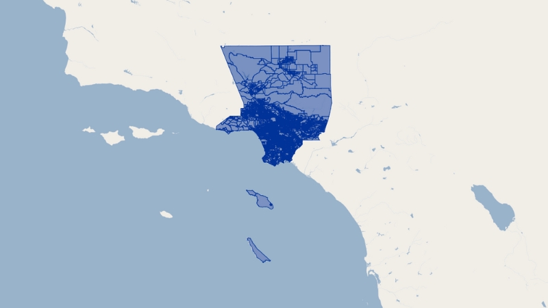
Los Angeles covers 502.7 square miles or about 1,302 square kilometers. Land accounts for 468.7 square miles. Water covers another 34 square miles.
The city extends roughly 44 miles from north to south and 29 miles from east to west. Its irregular perimeter runs for approximately 342 miles.
Los Angeles is California’s largest city by population, but not by land area. Several sparsely populated California municipalities cover more territory. Los Angeles stands apart because it combines a vast municipal footprint with nearly four million residents.
Terrain changes repeatedly within the city. Coastal plains rise into the Santa Monica Mountains. The range separates the Los Angeles Basin from the San Fernando Valley. Canyons and hills create physical breaks between neighborhoods that look close on a flat map.
The Highest and Lowest Parts of the City
Mount Lukens is the highest point inside Los Angeles at about 5,074 feet or 1,547 meters. It rises above the northern edge of the city near the Crescenta Valley.
Other elevated areas include Mount Washington, the Hollywood Hills, Baldwin Hills, San Pedro and the slopes surrounding Northeast Los Angeles. The Pacific Ocean forms the lowest boundary at sea level.
Elevation affects temperature, rainfall, road access and wildfire exposure. A coastal neighborhood may be cool and cloudy on the same afternoon that Woodland Hills records triple-digit heat.
City, County and Metro Boundaries Are Not the Same
“Los Angeles” can refer to three different places.
| Geographic Area | What It Covers | Approximate Population |
|---|---|---|
| City of Los Angeles | Municipal territory governed by the City of Los Angeles | About 3.88 million |
| Los Angeles County | Los Angeles plus 87 other incorporated cities and unincorporated communities | About 9.7 million |
| Los Angeles Metro Area | Los Angeles and Orange counties under the federal metropolitan definition | About 12.8 million |
| Greater Los Angeles CSA | The metro area plus Riverside, San Bernardino and Ventura counties | More than 18 million |
Beverly Hills, Santa Monica and West Hollywood are not Los Angeles neighborhoods. Each has its own municipal government. Unincorporated East Los Angeles is also separate from the City of Los Angeles, despite sharing the name.
Rivers and Waterways
The Los Angeles River begins near Canoga Park, where Bell Creek and Arroyo Calabasas meet. It travels about 51 miles through the San Fernando Valley and central Los Angeles before reaching the Pacific Ocean at Long Beach.
Federal engineers enclosed much of the river in concrete after destructive floods during the first half of the 20th century. The channel moves stormwater rapidly through heavily developed areas. It also separates neighborhoods and limits natural habitat.
Revitalization plans seek to restore vegetation, public access and ecological functions along selected sections. Flood protection remains essential, so the river cannot simply be returned to its earlier condition.
Ballona Creek drains western Los Angeles and enters Santa Monica Bay at Playa del Rey. Smaller channels carry runoff through the basin during storms.
Where Los Angeles Gets Its Water
Most local rainfall arrives during a short winter season. The city therefore relies on several distant and local sources.
- The Los Angeles Aqueduct carries water from the Eastern Sierra.
- The California Aqueduct brings water from Northern California through the State Water Project.
- The Colorado River Aqueduct supplies Southern California from the Colorado River.
- Groundwater basins provide part of the local supply.
- Recycling, conservation and stormwater capture reduce dependence on imported water.
The Los Angeles Department of Water and Power manages the city’s water system. Drought, reduced Colorado River flows and climate change have increased pressure to develop more reliable local supplies.
Vegetation
The ‘Bird of paradise’, also called ‘Strelitzia reginae’ is a flower which resembles a brightly coloured bird in flight. If you ask me this magnificent flower represents the paradise itself. ?️ pic.twitter.com/zJ5qzwY822
— Flower Show (@TheFlowerShow) June 7, 2024
Los Angeles contains beaches, wetlands, river corridors, hills and mountain habitat. Native plant communities include coastal sage scrub, chaparral and riparian woodland.
California poppies, coast live oaks, sycamores, willows, ceanothus and toyon grow naturally in the region. Development has reduced habitat for rare plants, including the Los Angeles sunflower.
The palms associated with Los Angeles were largely planted for landscaping and promotion. Mexican fan palms, Canary Island date palms and queen palms are not native to the city. The California fan palm grows naturally in desert oases farther inland. The history of Los Angeles palm trees is therefore a story of urban design rather than untouched nature.
- Official city tree: Coral Tree, Erythrina caffra
- Official city flower: Bird of Paradise, Strelitzia reginae
- Official native plant: Toyon, Heteromeles arbutifolia
Geology and Earthquake Risk
Los Angeles sits in a tectonically active region created by movement between the Pacific and North American plates. The famous San Andreas Fault passes through Southern California but does not run directly beneath Downtown Los Angeles.
The regional hazard comes from a network of faults. The Newport-Inglewood, Hollywood, Raymond, Sierra Madre and Puente Hills systems can all produce damaging earthquakes. Blind thrust faults are especially difficult to recognize because they do not create an obvious break at the surface.
Southern California records thousands of earthquakes each year. Most are too small to be felt. The number should not be interpreted as thousands of dangerous events.
- 1857 Fort Tejon earthquake: Estimated magnitude 7.9
- 1933 Long Beach earthquake: Magnitude 6.4
- 1971 San Fernando earthquake: Magnitude 6.6
- 1994 Northridge earthquake: Magnitude 6.7, with 57 deaths and extensive regional damage
Low-lying harbor communities can also experience tsunami effects. Waves generated by the 1964 Alaska earthquake and the 2011 Japan earthquake caused damage or strong currents along parts of the California coast.
Climate Changes From the Coast to the Valley
Los Angeles has warm, dry summers and mild winters. Climate classifications vary by location. Downtown is commonly described as hot-summer Mediterranean or semi-arid, while coastal and valley neighborhoods experience different conditions.
Downtown receives about 14.7 inches of rain in an average year. Most falls between November and March. Annual totals vary sharply. A wet winter can bring several times more rain than a dry one.
Mountain slopes receive more precipitation because rising air cools and releases moisture. Coastal neighborhoods stay cooler during summer because of the Pacific Ocean. Inland valleys can be 20 degrees warmer on the same day.
- Downtown annual mean temperature: About 65.8°F or 18.8°C
- Woodland Hills record: 121°F or 49°C in September 2020
- Downtown record low: 28°F or minus 2°C in January 1949
- Usual rainy season: November through March
Late spring and early summer often bring a layer of cool marine cloud known locally as May Gray or June Gloom. Autumn can produce the opposite effect. Dry offshore Santa Ana winds move from inland areas toward the coast, raising temperatures and increasing wildfire danger.
Wildfire and Flood Risk Can Exist in the Same Neighborhood
Homes near brush-covered hills face wildfire exposure during dry and windy periods. Burned slopes can later produce debris flows when intense rain arrives.
Flat sections of the basin face a different problem. Streets, parking lots and buildings prevent water from soaking into the soil. Short periods of heavy rain can overwhelm drains and flood roads even when annual rainfall remains low.
The Los Angeles County emergency portal publishes guidance for wildfires, earthquakes, floods and other regional hazards.
Air Quality Has Improved, but the Problem Remains
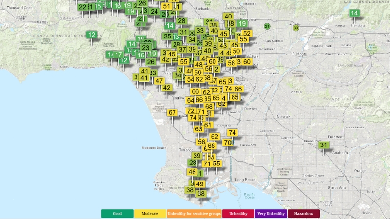
Vehicle traffic, port operations, warehouses, industry and wildfire smoke all affect air quality. Mountains surrounding the basin limit air movement. Temperature inversions can hold polluted air close to the ground.
Vehicle emission standards and cleaner fuels produced major improvements after the severe smog of the 20th century. The region still records unhealthy ozone and particle pollution, particularly in inland communities.
- First-stage smog alerts have become rare after occurring frequently during the 1970s.
- The American Lung Association city rankings continue to place the Los Angeles region among the most affected areas for ozone pollution.
- Communities near freeways, ports and freight corridors often carry a greater share of the health burden.
Los Angeles Population and Regional Scale
Los Angeles is the county seat of Los Angeles County. The official 2020 Census counted 3,898,747 residents inside the city.
The latest completed Census estimate available for direct city comparisons placed the population near 3.88 million. Estimates can differ because the Census Bureau, California Department of Finance and private demographic services use different dates and methods.
The figure of 3,878,704 residents is a projection rather than a decennial census count. It should not be presented as an official head count.
World Population Review publishes current projections for Los Angeles, including estimates for household income, age and poverty. The official Census count remains the firmest benchmark.
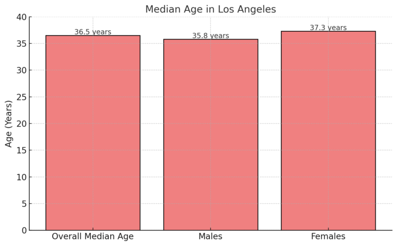
The median age is about 36 years. Los Angeles remains younger than many large U.S. cities, although its population is aging as birth rates fall and the number of older residents grows.
The metropolitan area had 13.2 million residents at the 2020 Census. Current estimates place it near 12.8 million. Greater Los Angeles, which also includes the Inland Empire and Ventura County, has more than 18 million residents.
The region ranks behind the New York metropolitan area in the United States. International comparisons require caution because countries define metropolitan areas differently.
Population Density Is Uneven
The 2020 Census recorded an average of 8,304.2 residents per square mile inside Los Angeles. That average hides large differences.
Koreatown, Westlake, East Hollywood and Pico-Union contain apartment blocks with very high density. Hillside neighborhoods, industrial districts and parts of the San Fernando Valley have far fewer residents per square mile.
Census data for Los Angeles County cover a much larger area than the city. County figures should not be labeled as city statistics without checking the geography first.
Los Angeles Speaks Hundreds of Languages
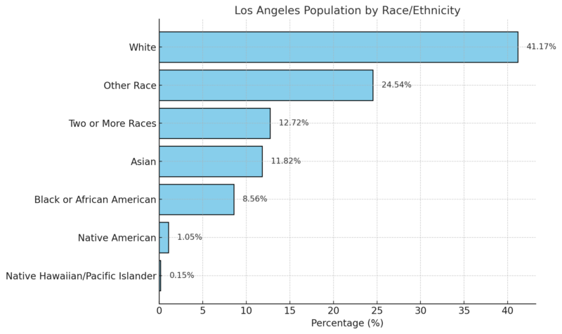
Los Angeles residents have roots in more than 140 countries. More than 200 languages are spoken in homes and communities throughout the region.
Mexican heritage has the largest influence on the city’s Latino population. Salvadoran and Guatemalan communities are also substantial. Korean, Filipino, Chinese, Japanese, Thai, Iranian, Armenian and Ethiopian communities have built recognizable commercial and cultural districts.
Koreatown, Historic Filipinotown, Chinatown, Little Tokyo, Little Armenia and the Persian business corridor commonly called Tehrangeles show how migration has shaped the map. None has perfectly fixed boundaries. Cultural districts often overlap with official neighborhoods and business zones.
Why the Population Has Stopped Growing Quickly
Los Angeles expanded rapidly through most of the 20th century. Growth has slowed and, under some estimates, reversed during recent years.
High housing costs are a central reason. Limited construction, expensive land and long approval processes make it difficult to add homes in areas with strong demand. Domestic migration has also shifted residents toward less expensive counties and states.
International immigration and natural population change continue to add residents, but not always fast enough to offset departures. Annual estimates can move considerably when federal agencies revise migration assumptions.
Largest Cities in California
The following figures are projections for comparison. They are not all official Census counts for the same reference date.
| Rank | City | 2025 Population Estimate | Approximate Land Area |
|---|---|---|---|
| 1 | Los Angeles | 3,878,704 | 468.7 sq mi |
| 2 | San Diego | 1,406,106 | 325.9 sq mi |
| 3 | San Jose | 989,814 | 178.3 sq mi |
| 4 | San Francisco | 826,079 | 46.9 sq mi |
| 5 | Fresno | 555,549 | 115.2 sq mi |
| 6 | Sacramento | 536,449 | 98.6 sq mi |
| 7 | Long Beach | 450,469 | 50.7 sq mi |
| 8 | Oakland | 440,838 | 55.9 sq mi |
| 9 | Bakersfield | 422,165 | 150.3 sq mi |
| 10 | Anaheim | 341,008 | 50.3 sq mi |
Los Angeles remains California’s largest city by a wide margin. Its estimated population of 3,869,089 is more than twice the San Diego total and almost four times the population of San Jose.
The figures represent incorporated city populations rather than counties or metropolitan regions. They are U.S. Census Bureau estimates for July 1, 2025. Land area excludes water.
Los Angeles remains far larger than any other California city. San Francisco is much smaller by area but considerably denser. Inland cities such as Bakersfield and Fresno have more room for outward housing development.
How Los Angeles Neighborhoods Fit Together
Los Angeles has no single official master list of neighborhoods with universally accepted borders. Planning districts, police divisions, ZIP codes, council districts and community maps all divide the city differently.
Central Los Angeles
Downtown, Koreatown, Hollywood, East Hollywood, Westlake, Pico-Union, Mid-Wilshire and nearby communities form the dense central section. Rail service is strongest here, but travel times still vary with traffic and transfers.
The San Fernando Valley
The Valley contains communities including Van Nuys, North Hollywood, Encino, Reseda, Woodland Hills and Northridge. It occupies a large share of the city’s land and experiences hotter summers than the coast.
West Los Angeles and the Coast
Westwood, Brentwood, Pacific Palisades, Venice, Mar Vista and Playa del Rey sit on the western side. Santa Monica is an independent city. Marina del Rey is an unincorporated county community.
South Los Angeles and the Harbor
South Los Angeles includes communities such as Crenshaw, Leimert Park, Watts and Historic South-Central. Farther south, the Harbor Gateway connects the main city to Wilmington, San Pedro and the Port of Los Angeles.
Northeast and East Los Angeles
Silver Lake, Echo Park, Highland Park, Eagle Rock, Boyle Heights and El Sereno occupy the eastern and northeastern sections. East Los Angeles lies outside the city as an unincorporated county community.
Getting Around Los Angeles
Distance on a Los Angeles map can be deceptive. Ten miles may take 20 minutes under light traffic or more than an hour during a busy period.
Freeways remain central to regional travel. Interstate 5, Interstate 10, Interstate 405, U.S. Route 101 and State Route 110 carry enormous daily traffic volumes.
Metro operates rail and bus services throughout Los Angeles County. The network connects Downtown with Hollywood, Santa Monica, Long Beach, Pasadena, East Los Angeles, Inglewood and other communities. Service does not reach every destination directly, so many trips require a bus connection.
The Metro trip planner provides current routes, transfers and service information.
Travel Times Matter More Than Mileage
| Route | Approximate Distance | What Affects the Trip |
|---|---|---|
| Downtown to Santa Monica | About 15 miles | I-10 traffic or E Line travel time |
| Hollywood to LAX | About 14 miles | US-101, I-405 and surface-road congestion |
| Downtown to Disneyland | About 27 miles | I-5 traffic and Anaheim event demand |
| Downtown to San Pedro | About 25 miles | I-110 traffic and port freight activity |
| Santa Monica to Pasadena | About 27 miles | Cross-basin traffic and multiple freeway routes |
Economy of Los Angeles
Los Angeles supports one of the largest urban economies in the world. Entertainment remains its best-known industry, but the regional economy also depends on trade, logistics, healthcare, tourism, aerospace, manufacturing, education, technology and professional services.
The Los Angeles-Long Beach-Anaheim metropolitan economy produced roughly $1.35 trillion in 2024 when county-level figures are aggregated. Comparisons with international cities remain approximate because economic boundaries differ.
The Ports of Los Angeles and Long Beach form the largest container port complex in the United States. Warehouses, rail yards and trucking corridors extend far inland from the harbor.
Kaiser Permanente, the University of Southern California, local governments, school systems and aerospace companies rank among the largest employers in the region. AECOM, CBRE Group and Reliance Steel & Aluminum are major publicly traded companies associated with Los Angeles. Disney, SpaceX and Warner Bros. operate in nearby independent cities within the wider metropolitan area.
Los Angeles is also the country’s largest legal cannabis market, although licensed businesses continue to compete with illegal sellers.
Housing Costs Shape the Economy
High rents and home prices affect hiring, migration and household stability. Workers can hold full-time jobs and still struggle to live near their workplace.
Office vacancies remain elevated in parts of Downtown Los Angeles. Remote work, company relocations and concerns about the central business district have reduced demand. Other areas, including Century City and sections of the Westside, have performed differently.
Hollywood Is Only One Part of the Entertainment Industry
Hollywood is the symbolic center of American film, but production activity spreads across Los Angeles County. Burbank, Culver City, Studio City and Universal City contain major studios and production facilities.
The Dolby Theatre near Hollywood Boulevard has hosted the Academy Awards since 2002. Production employment remains important, although Los Angeles now competes with Georgia, New York, Canada, the United Kingdom and other locations offering lower costs or tax incentives.
Major Attractions in and Around Los Angeles
Several famous destinations marketed as Los Angeles are located in separate cities. Disneyland is in Anaheim. The Santa Monica Pier is in Santa Monica. Universal Studios Hollywood occupies an unincorporated area known as Universal City.
1. Hollywood Walk of Fame
The Hollywood Walk of Fame extends along Hollywood Boulevard and Vine Street. More than 2,700 stars recognize figures from film, television, music, radio, theater and sports entertainment.
The busiest section lies near Hollywood and Highland. Visitors should expect crowds, street performers and heavy traffic rather than a quiet museum environment.
2. Disneyland Park
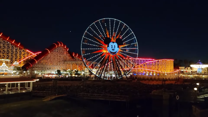
Disneyland opened in Anaheim in 1955. The resort is about 27 miles southeast of Downtown Los Angeles and should not be plotted inside the City of Los Angeles.
Disneyland Park contains Sleeping Beauty Castle, Adventureland, Tomorrowland and other themed areas. Disney California Adventure sits beside it.
3. La Brea Tar Pits and Museum
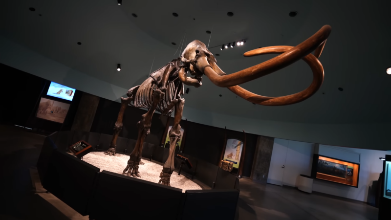
The La Brea Tar Pits preserve Ice Age fossils beneath the center of modern Los Angeles. Excavations have recovered mammoths, dire wolves, saber-toothed cats and numerous smaller species.
The site remains an active research area rather than a reconstructed display alone. Visitors can see excavation pits outside the museum.
4. Natural History Museum of Los Angeles County
The Natural History Museum stands in Exposition Park beside the California Science Center and the Los Angeles Memorial Coliseum. Its collections cover dinosaurs, mammals, minerals, regional history and urban nature.
The Dinosaur Hall contains more than 20 mounted skeletons and a growth series showing Tyrannosaurus rex at different ages.
5. Hollywood Bowl
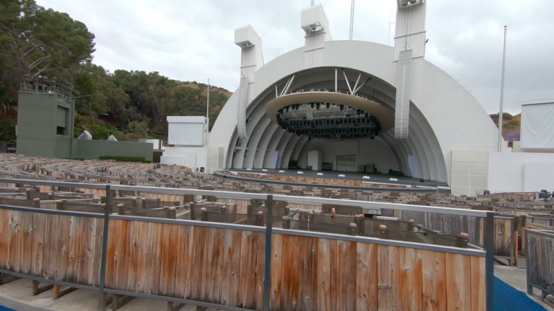
The Hollywood Bowl hosts orchestral concerts, film events and major touring performers. Its shell-shaped stage sits in a natural amphitheater in the Hollywood Hills.
Parking can be difficult during major events. Shuttle and park-and-ride services are often more practical than driving directly to the venue.
6. Universal Studios Hollywood
Universal Studios Hollywood combines a working studio with a theme park. The Studio Tour passes film sets and production areas, although the exact route changes with filming schedules.
The Wizarding World of Harry Potter, Super Nintendo World and Jurassic World rank among the park’s main attractions.
7. Getty Center
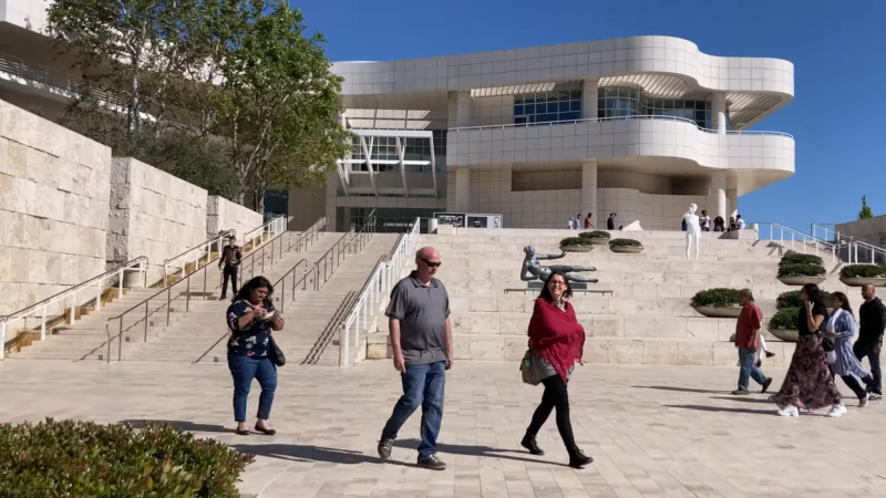
The Getty Center combines European art, modern architecture, gardens and wide views over Los Angeles. Its collections include works by Van Gogh, Monet and Rembrandt.
General admission is free, although parking carries a charge. Timed reservations may be required.
8. Museum of Contemporary Art
2/2
…found crystal balls, convex mirror, polymer clay, hardware, LED candles, logs, sticks, volcanic rocks, monitor, video, Installation dimensions variable, The Museum of Contemporary Art, Los Angeles, Gift of the artist and Jeffrey Deitch] pic.twitter.com/5B3rxDVLj9— MOCA (@MOCAlosangeles) September 8, 2022
MOCA concentrates on art created after 1940. Its collection includes work by Mark Rothko, Jackson Pollock, Barbara Kruger and numerous California artists.
The museum operates more than one location. Visitors should check which building contains a particular exhibition before traveling.
9. Griffith Park and Observatory
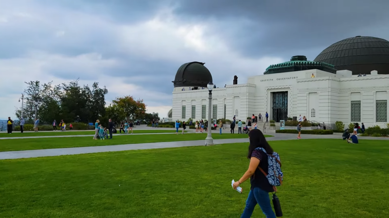
Griffith Park covers more than 4,200 acres. Trails reach Mount Hollywood, the Hollywood Sign area and ridges overlooking the basin.
Griffith Observatory offers astronomy exhibits, public telescopes and broad views of the city. Entry to the building and grounds is free. Planetarium programs require tickets.
10. Original Muscle Beach in Santa Monica
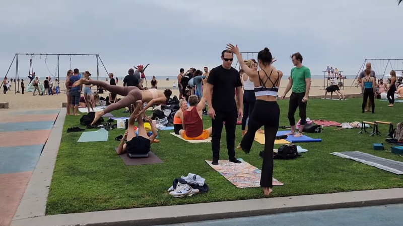
Original Muscle Beach sits beside the Santa Monica Pier. Gymnasts and acrobats made the site famous during the 20th century.
Muscle Beach Venice, a separate outdoor weightlifting area, is located farther south in Venice. The two sites are frequently confused.
11. Los Angeles City Hall
Los Angeles City Hall opened in 1928 and rises 454 feet above the Civic Center. Its height influenced the city skyline for decades because older rules restricted most other buildings.
The public observation level has historically offered views of Downtown, but access can change because of security requirements and building operations.
12. Los Angeles International Airport
LAX lies about 18 road miles southwest of Downtown. It is one of the busiest airports in the United States and a major gateway between North America, Asia and the Pacific.
Traffic around the terminal loop can add substantial time to a journey. Travelers should check current construction, transit and pickup arrangements before departure.
13. Ontario International Airport
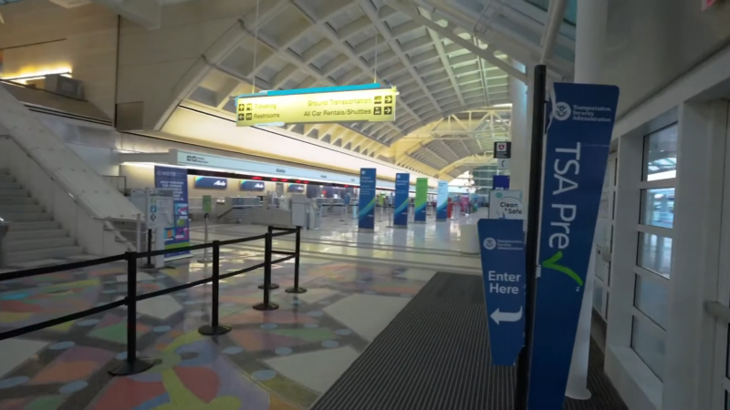
Ontario International Airport is about 40 miles east of Downtown Los Angeles. It is no longer officially branded as LA/Ontario International Airport.
The airport can be useful for travelers staying in San Bernardino County, Riverside County or the eastern San Gabriel Valley. It is not always convenient for destinations on the Westside or coast.
14. The Broad

The Broad stands on Grand Avenue beside Walt Disney Concert Hall. Its collection includes works by Jean-Michel Basquiat, Yayoi Kusama, Jeff Koons and Cindy Sherman.
General admission is free. Popular installations can require a separate reservation or waiting list.
15. Santa Monica Pier
The Santa Monica Pier contains Pacific Park, an aquarium, restaurants and the western end of historic Route 66. It is located in the independent City of Santa Monica.
The pier is reachable from Downtown Los Angeles on Metro’s E Line, followed by a short walk through central Santa Monica.
16. Venice Beach Boardwalk
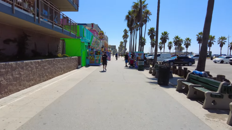
Venice Beach is part of the City of Los Angeles. The boardwalk brings together performers, vendors, murals, basketball courts, a skate park and Muscle Beach Venice.
The Venice Canals sit several blocks inland. Abbot Kinney Boulevard forms another commercial center with restaurants and shops.
17. Dodger Stadium
Dodger Stadium opened in 1962 and remains one of Major League Baseball’s oldest active ballparks. It stands in Chavez Ravine north of Downtown.
Views extend toward the skyline and San Gabriel Mountains. Event traffic can be severe, especially immediately before and after games.
18. The Grove and Original Farmers Market
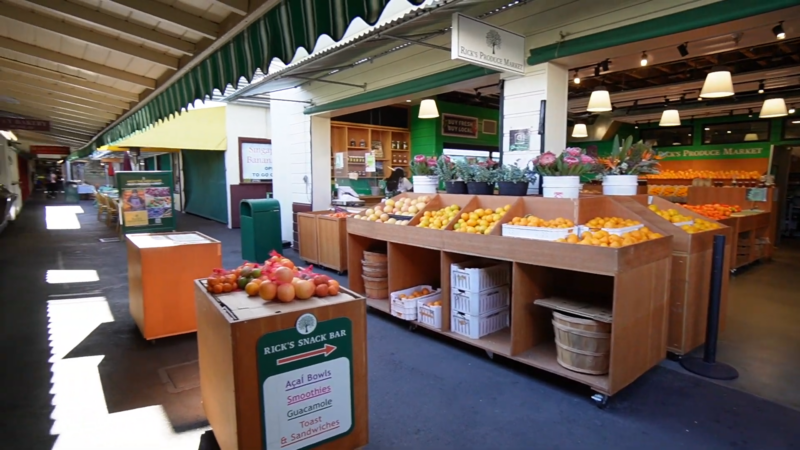
The Grove is an open-air shopping complex beside the historic Original Farmers Market.
The market contains food counters, produce sellers and specialty businesses. Its independent stalls offer a different experience from the chain stores at The Grove.
19. Los Angeles County Museum of Art
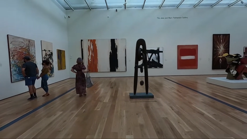
LACMA is the largest art museum in the western United States. Its collection spans ancient objects, Asian art, European painting, Latin American art, photography and modern work.
The campus has undergone major reconstruction. Visitors should check current gallery access before arriving. Chris Burden’s Urban Light remains outside the museum.
20. Runyon Canyon Park
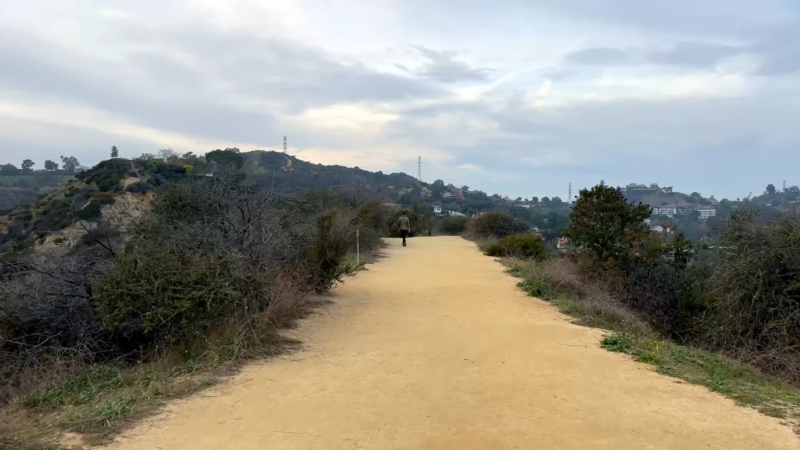
Runyon Canyon provides hiking routes and city views near Hollywood. Its central location makes it popular with residents, visitors and dog owners.
Shade is limited on many trails. Heat and dehydration become serious concerns during summer. Los Angeles also offers access to larger natural areas through the California state park system.
Planning a Visit With the Map
Grouping destinations by area saves more time than selecting attractions only by popularity. Los Angeles rewards geographic planning.
| Area | Destinations That Work Well Together |
|---|---|
| Downtown | The Broad, MOCA, City Hall and Grand Central Market |
| Hollywood | Walk of Fame, Hollywood Bowl and Griffith Observatory |
| Mid-City | LACMA, La Brea Tar Pits, The Grove and Farmers Market |
| Coast | Santa Monica Pier, Venice Beach and Venice Canals |
| Exposition Park | Natural History Museum, California Science Center and Memorial Coliseum |
Trying to combine Disneyland, Malibu, Hollywood and Downtown in one day creates more driving than sightseeing. A map should be used to build regional clusters rather than a simple list of famous names.
Frequently Asked Questions
Is Beverly Hills part of Los Angeles?
Beverly Hills is an independent city surrounded largely by Los Angeles. It has its own municipal government and police department.
Is Disneyland located in Los Angeles?
No. Disneyland is in Anaheim, approximately 27 miles southeast of Downtown Los Angeles.
What is the difference between Los Angeles and Los Angeles County?
The City of Los Angeles is one municipality. Los Angeles County contains 88 incorporated cities, including Los Angeles, and many unincorporated communities.
What is the highest point in Los Angeles?
Mount Lukens is the highest point inside the city at approximately 5,074 feet.
How far is Los Angeles from the Pacific Ocean?
Parts of the city reach the ocean at Venice, Pacific Palisades, Playa del Rey and San Pedro. Downtown is roughly 15 to 20 miles from the coast, depending on the destination.
The Bottom Line
A map of Los Angeles tells a story that photographs of palm trees and the Hollywood Sign cannot. The city is a collection of valleys, hills, coastal communities, dense apartment districts, industrial corridors and former towns joined through annexation.
Its boundaries explain why San Pedro belongs to Los Angeles, why Santa Monica does not and why a short distance can produce a long journey. Mountains shape weather and traffic. Imported water made expansion possible. Ports, airports, studios and migration turned the region into a global economic center.
Los Angeles is easier to read when city limits, county lines and metropolitan boundaries are kept separate. Once those layers are clear, its unusual geography begins to look less chaotic and far more revealing.
References
- World Population Review – Los Angeles Population
- U.S. Census Bureau – Los Angeles County Census Data
- Koordinates – Geography of Los Angeles, CA
- U.S. Census Bureau QuickFacts – Los Angeles City Population and Housing Data
- City of Los Angeles – Official Los Angeles City Information
- Los Angeles Metro – Regional Transit Maps and Services
- Los Angeles Department of Water and Power – Los Angeles Water System