
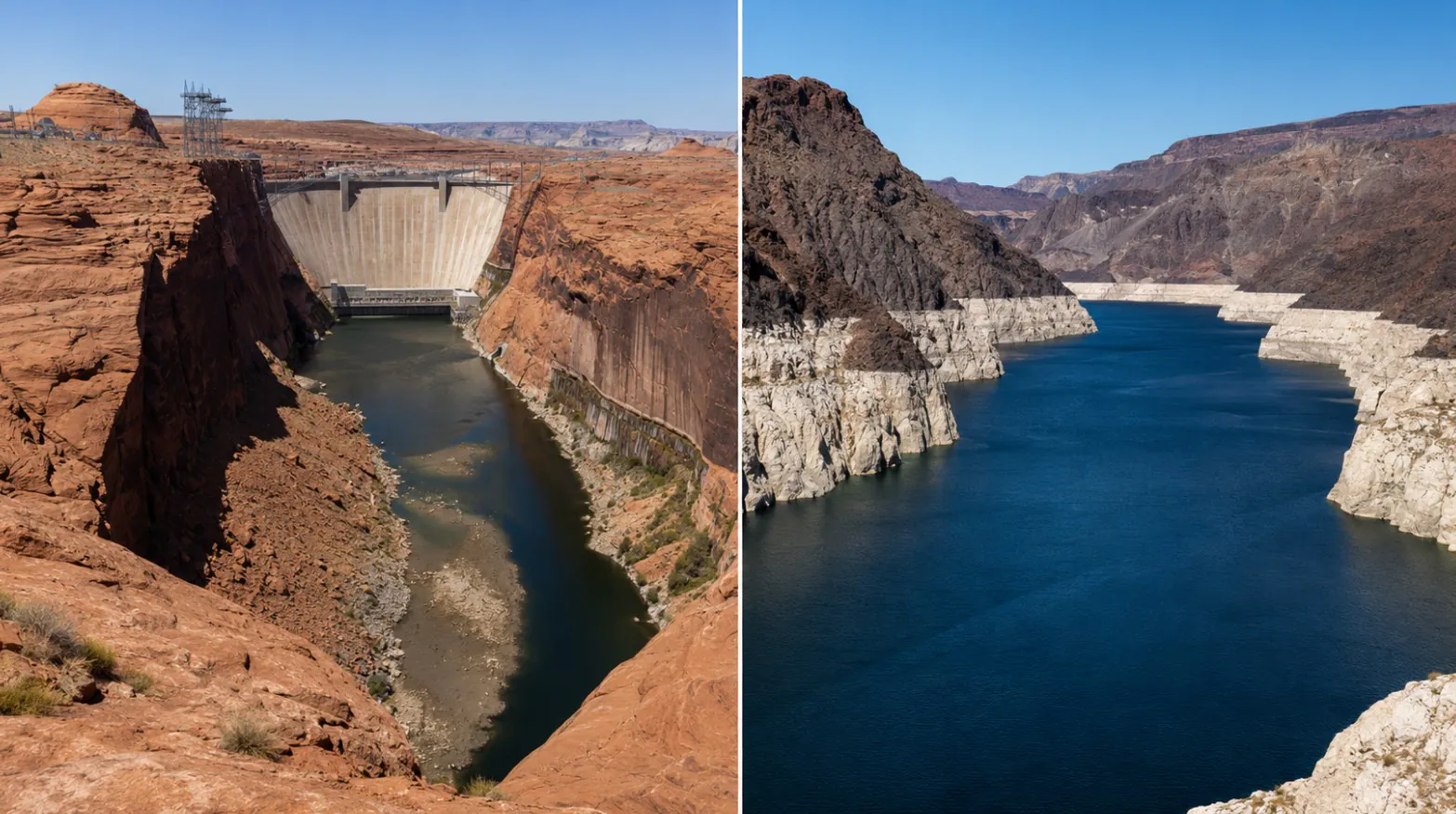
Lake Mead and Lake Powell have fallen to their lowest combined level since 1957, leaving the two reservoirs with less than one-quarter of their full storage capacity.
The record is not limited to an empty marina or another visible white line on the canyon walls. Both reservoirs support a Colorado River system that provides water to cities, farms and tribal communities across seven states. Glen Canyon Dam and Hoover Dam also generate electricity for customers throughout the Southwest.
Lake Powell stood at 3,523.43 feet on July 19 and was 23% full. Lake Mead was at 1,041.81 feet and 27% full, according to the Bureau of Reclamation’s latest weekly reservoir report.
Both reservoirs lost close to another foot during the preceding week. The Colorado River system as a whole held 19.1 million acre-feet of water, compared with 23.1 million acre-feet at the same point in 2025.
Latest Update: The officials are now planning to introduce payments for cutting water use in the Colorado river.
How Low Are Lake Mead and Lake Powell?
| Reservoir | Water level on July 19 | Percent full | Projected level at the end of 2026 |
|---|---|---|---|
| Lake Powell | 3,523.43 feet | 23% | 3,507.68 feet |
| Lake Mead | 1,041.81 feet | 27% | 1,037.31 feet |
The combined amount of water in the two reservoirs has not been this low since Glen Canyon Dam was still being built and Lake Powell did not exist as a completed reservoir. A group of Colorado River researchers identified the new record after comparing current storage with historical records, according to CNN.
Lake Mead reached its individual record low in July 2022. It is now less than a foot above that mark. Lake Powell is already at its lowest recorded July level and is expected to keep falling through the rest of the summer.
Who Depends on the Colorado River?
The Colorado River serves around 40 million people. Its water reaches Colorado, New Mexico, Utah, Wyoming, Arizona, Nevada and California, as well as tribal nations and communities in Mexico.
Lake Powell sits on the border of Utah and Arizona. Lake Mead is located east of Las Vegas, between Nevada and Arizona. Population growth has increased demand in the region, particularly across fast-growing parts of Arizona and Nevada.
The river also irrigates millions of acres of farmland. Produce, livestock feed and other crops grown with Colorado River water are sold across the country, so deeper water cuts would not remain a local problem.
| Area | How the river is used |
|---|---|
| Cities and towns | Drinking water, sanitation and commercial use |
| Farms | Irrigation for crops and livestock feed |
| Tribal communities | Household water, agriculture and recognized water rights |
| Power customers | Electricity generated at Glen Canyon and Hoover dams |
| Recreation businesses | Boating, fishing, marinas and tourism |
Lake Powell Is Moving Closer to a Critical Power Level
The most immediate concern is at Glen Canyon Dam, where falling water reduces the pressure needed to turn the turbines efficiently.
Under the Bureau of Reclamation’s July dry-weather projection, Lake Powell could fall to 3,488.77 feet in February 2027. That would place the reservoir near or below the minimum power pool around 3,490 feet, where normal hydropower generation becomes difficult to maintain.
Losing power production at Glen Canyon Dam would not cause the entire Southwest electrical system to fail. Other power sources would have to replace the missing electricity, however, and the dam would lose part of its ability to generate revenue used for river management and environmental programs.
Water releases could continue through lower outlet pipes. Operating a major dam without normal turbine releases would give water managers fewer options and place more pressure on equipment not intended to handle the entire flow for long periods.
A Dry Winter Left Little Water for the Reservoirs
Most Colorado River water begins as mountain snow. The snowpack stores water through winter and releases it gradually during spring and early summer.
Water-year precipitation in the Upper Basin reached only 78% of normal by July 19. Forecast inflow into Lake Powell for the full 2026 water year was 3.5 million acre-feet, or 36% of normal. The April through July inflow was expected to reach just 17% of normal.
Long-term drought and high temperatures have made the problem worse. Hotter air increases evaporation from reservoirs, rivers and soil. Dry ground also absorbs more melting snow before the water can reach streams.
Current drought maps and basin measurements can be followed through the federal Colorado River Basin conditions page.
The Seven States Still Have No Long-Term Deal
The rules used to divide Colorado River water were written when the river carried more water than it does today. Existing shortage guidelines are nearing their end, yet the seven basin states have not agreed on how future cuts should be shared.
The Upper Basin includes Colorado, New Mexico, Utah and Wyoming. The Lower Basin includes Arizona, California and Nevada. Lower Basin states use water released from Lake Powell into Lake Mead, giving the two reservoirs a direct connection even though the Grand Canyon lies between them.
The Department of the Interior told Congress in June that no agreement involving all seven states had been reached. Federal officials are preparing a new operating framework that can be used if the states remain divided.
Any agreement will require real reductions. The difficult question is how much should come from cities, farms and individual states. Tribal water rights and Mexico’s share of the river must also be considered.
What Happens Next?
Lake Mead and Lake Powell will probably continue falling through the summer and winter. Significant improvement would require a strong mountain snow season followed by cool spring conditions that allow runoff to reach the river.
One wet winter could provide temporary relief, but it would not replace the water lost during more than two decades of drought. Conservation, changes in agricultural water use and a new agreement among the states will still be needed.
No widespread shutoff has been announced. Residents should follow local water agencies rather than assume that a low reservoir automatically means their taps will run dry. The larger warning is hard to miss. The Southwest is using a river system that now stores far less water than the cities and farms around it were built to expect.