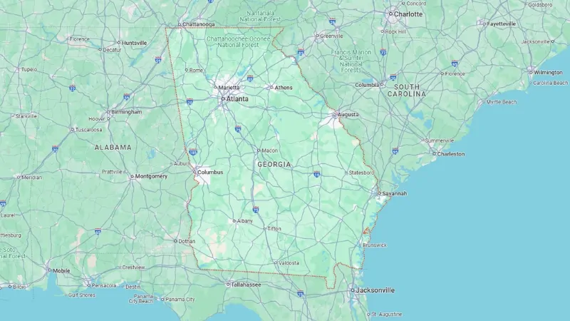
Georgia is a state in the Southeastern U.S., surrounded by a mix of neighboring states and coastlines.
To the north, it shares borders with Tennessee and North Carolina; South Carolina is to the northeast, with a touch of Atlantic Ocean coastline to the southeast.
Heading down, you reach Florida, and to the west, Georgia meets Alabama.
It’s the 24th largest state by area and ranks 8th in population, with an estimated 11,145,300 residents as of 2025.
Atlanta, the capital, is a major hub and the largest city in the state.
The Atlanta metropolitan area is home to over 6,193,000 people—more than half of Georgia’s entire population—making it the sixth most populated metro area in the country.
Besides Atlanta, Georgia has other important cities like Augusta, Savannah, Columbus, and Macon, each adding its unique flavor and regional influence to the state.
Georgia State Map and Satelite View
Georgia’s eastern border with South Carolina begins at the Atlantic Ocean and follows the Savannah River northwest to the confluence of the Tugaloo and Seneca Rivers.
This boundary then continues along the Tugaloo and into the Chattooga River, established by the 1797 Treaty of Beaufort, and later confirmed by two U.S. Supreme Court cases in 1923 and 1989.
At the northern tip of Rabun County (around latitude 35°N), the border shifts slightly south due to inaccuracies from an 1818 survey.
Originally, Georgia’s northern border with North Carolina extended to the Mississippi River until the formation of Tennessee and the sale of western lands (now parts of Alabama and Mississippi) by Georgia in 1795.
The western boundary of Georgia runs from southwest of Chattanooga, heading southeast to the Chattahoochee River, which flows down to its confluence with the Flint River, creating Florida’s Apalachicola River.
The southern border then stretches east to the St. Mary’s River, which leads back to the Atlantic Ocean.
Water boundaries are defined by the original river paths, though some areas have since been submerged by dam-created lakes, like Lake Seminole.
An error in the 1818 survey set Georgia’s border with Tennessee one mile south of the intended 35th parallel. Georgia still disputes this, as a correction would give it access to the Tennessee River’s water resources.
Geography Map
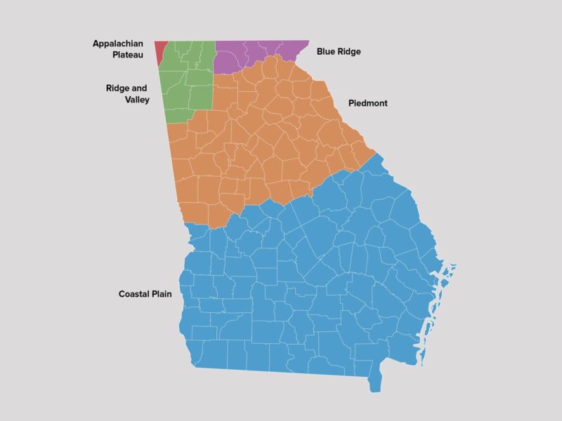
Georgia is divided into four primary geologic regions that closely align with its four physiographic regions: Appalachian Foreland, Blue Ridge, Piedmont, and Coastal Plain.
These regions have distinct geological characteristics due to tectonic activity from the Appalachian mountain-building events, with key features separated by major thrust faults.
1. Appalachian Foreland
The Appalachian Foreland, located in Georgia’s northwest, includes the Valley and Ridge and Appalachian Plateau physiographic regions.
It contains sedimentary rocks that were deposited along the ancient North American coastline before the Appalachian Mountains formed.
These rocks, dating back to the Cambrian and Ordovician periods, transitioned from a passive to active margin due to tectonic subduction in the Iapetus Ocean.
Key resources in this region include limestone, barite, ochre, and small coal deposits.
The prominent ridges in this area are created by folded rock layers, characteristic of a foreland fold and thrust belt developed during continental collision events.
2. Blue Ridge
The Blue Ridge region lies in North Georgia and comprises metamorphic rocks positioned between the Appalachian Foreland and Piedmont regions.
This area features Georgia’s highest elevations, including Brasstown Bald, and includes various metamorphic rocks, often separated into western, central, and eastern geological divisions.
Notably, the Blue Ridge contains the Georgia Gold Belt, where significant gold mining historically took place, as well as resources like marble and talc.
The rocks here were affected by the Taconic and later orogenies, leading to the formation of high-altitude landscapes and rich mineral resources.
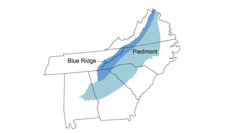
3. Piedmont
The Piedmont region is composed primarily of igneous and metamorphic rocks, creating a hilly landscape at lower elevations than the Blue Ridge.
Stretching from the Fall Line to the Valley and Ridge area, it includes significant geological features like Stone Mountain and the Brevard fault zone, which runs through major cities like Atlanta and Duluth.
The Piedmont’s geology reflects a complex history of tectonic activity, including ancient terranes formed near North America and Gondwana, some of which were sutured to the continent after the breakup of Pangea.
Key resources include granite and other metamorphic rocks that are valuable for construction.
4. Coastal Plain
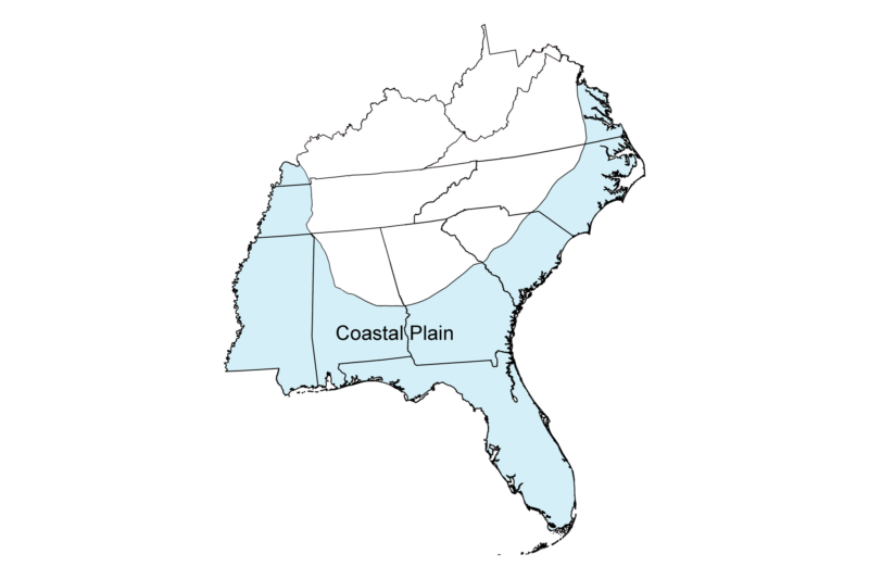
The Coastal Plain extends from the Fall Line (passing through cities like Augusta, Macon, and Columbus) to Georgia’s coast and is part of a broader plain stretching from New Jersey to Texas.
This region contains sedimentary rocks from the Late Cretaceous to Holocene periods, with Triassic basalt rifts underlying younger sediments.
Georgia’s Coastal Plain is rich in kaolin, a significant mineral resource, and contains marine and terrestrial fossils, including rare dinosaur fragments.
The Sandhills region, located within the Atlantic Coastal Plain, represents ancient sand deposits.
Major Bodies of Water and Rivers in Georgia
Georgia is home to numerous important bodies of water and rivers that serve vital ecological, recreational, and economic roles:
Savannah River
This river forms Georgia’s eastern border with South Carolina, ultimately flowing into the Atlantic Ocean.
It is a key resource for transportation, drinking water, and industry in the region.
Chattahoochee River
Essential for Georgia’s water supply, the Chattahoochee flows along the Alabama-Georgia border and eventually reaches the Gulf of Mexico.
This river is especially important for cities like Atlanta for drinking water and recreation.
Ocmulgee and Oconee Rivers
These two rivers merge to form the Altamaha River, which is one of the largest river basins on the eastern U.S. coast.
The Altamaha River basin is crucial for Georgia’s biodiversity and regional water management.
Lake Lanier
Georgia’s largest lake, Lake Lanier, is a man-made reservoir created for flood control, water supply, and recreation.
It is a major source of water for northern Georgia, including the Atlanta metropolitan area.
Atlantic Ocean
The southeastern border of Georgia along the Atlantic Ocean influences the state’s humid, subtropical climate, bringing high humidity and substantial rainfall, especially in coastal areas.
Ecology
View this post on Instagram
Georgia has about 250 tree species and 58 protected plants. Common native trees include red cedar, various pines, oaks, hollies, cypress, and the sabal palmetto.
The state’s subtropical coniferous forests in the southern and coastal regions support diverse evergreen species.
Flowering shrubs like yellow jasmine and mountain laurel add color to Georgia’s landscape.
White-tailed deer inhabit most counties. Among 160 bird species, the northern mockingbird and brown thrasher are notable.
Reptiles such as the eastern diamondback rattlesnake, copperhead, and cottonmouth are found statewide, along with amphibians like salamanders, frogs, and toads.
The Argentine black and white tegu lizard is an invasive species, posing threats to native wildlife.
Popular freshwater game fish include trout, bream, bass, and catfish, with restocking efforts supported by state hatcheries.
Saltwater fish, such as red drum, spotted seatrout, flounder, and tarpon, are common off Georgia’s coast.
Marine species like porpoises, whales, shrimp, oysters, and blue crabs are also found nearshore and offshore.
Climate of Georgia
Most of Georgia experiences a humid subtropical climate, with hot, humid summers and mild winters.
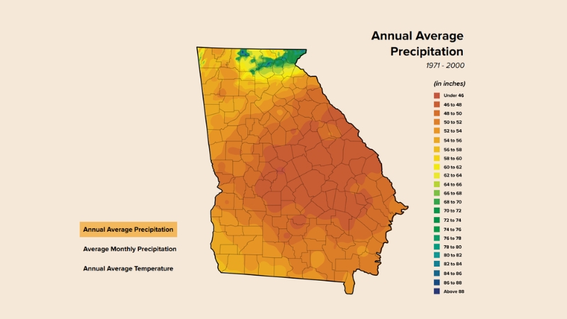
Annual precipitation ranges from 45 inches in central areas to 75 inches in the northeastern mountains.
The climate varies by latitude, proximity to the Atlantic Ocean or Gulf of Mexico, and elevation.
- Temperature Extremes: The highest recorded temperature was 112 °F (44 °C) in Louisville in 1952, and the lowest was −17 °F (−27 °C) in northern Floyd County in 1940.
- Severe Weather: Georgia has frequent tornadoes, though they are usually mild. The state is also vulnerable to hurricanes, particularly those affecting the Florida Panhandle or passing near the Georgia coast.
The USDA plant hardiness zones range from zone 6b (in the Blue Ridge Mountains) to zone 8b (along the Atlantic coast and Florida border).
Monthly Average High and Low Temperatures for Major Georgia Cities
City
Jan (°F/°C)
Feb (°F/°C)
Mar (°F/°C)
Apr (°F/°C)
May (°F/°C)
Jun (°F/°C)
Jul (°F/°C)
Aug (°F/°C)
Sep (°F/°C)
Oct (°F/°C)
Nov (°F/°C)
Dec (°F/°C)
Athens
51/33 (11/1)
56/35 (13/2)
65/42 (18/6)
73/49 (23/9)
80/58 (27/14)
87/65 (31/18)
90/69 (32/21)
88/68 (31/20)
82/63 (28/17)
73/51 (23/11)
63/42 (17/6)
54/35 (12/2)
Atlanta
52/34 (11/1)
57/36 (14/2)
65/44 (18/7)
73/50 (23/10)
80/60 (27/16)
86/67 (30/19)
89/71 (32/22)
88/70 (31/21)
82/64 (28/18)
73/53 (23/12)
63/44 (17/7)
55/36 (13/2)
Augusta
56/33 (13/1)
61/36 (16/4)
69/42 (21/6)
77/48 (25/9)
84/57 (29/14)
90/65 (32/18)
92/70 (33/21)
90/68 (32/20)
85/62 (29/17)
76/50 (24/10)
68/41 (20/5)
59/35 (15/2)
Columbus
57/37 (14/3)
62/39 (17/4)
69/46 (21/8)
76/52 (24/11)
83/61 (28/16)
90/69 (32/21)
92/72 (33/22)
91/72 (32/22)
86/66 (30/19)
77/54 (25/12)
68/46 (20/8)
59/39 (15/4)
Macon
57/34 (14/1)
61/37 (16/3)
68/44 (20/7)
76/50 (24/10)
83/59 (28/15)
90/67 (32/19)
92/70 (33/21)
90/70 (32/21)
85/64 (29/18)
77/51 (25/11)
68/42 (20/6)
59/36 (15/2)
Savannah
60/38 (16/3)
64/41 (18/5)
71/48 (22/9)
78/53 (26/12)
84/61 (29/16)
90/68 (32/20)
92/72 (33/22)
90/71 (32/22)
86/67 (30/19)
78/56 (26/13)
70/47 (21/8)
63/40 (17/4)
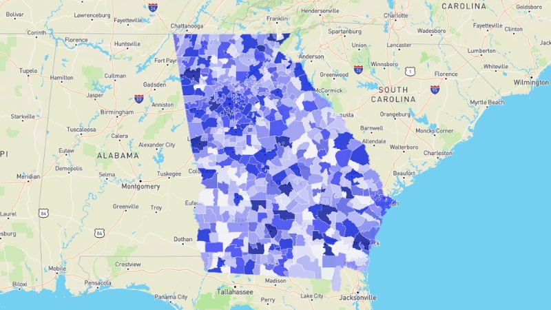
Population Heat Map Georgia
The latest population estimate for Georgia is approximately 11,145,300. In the 2010 Census, the population was 9,687,653, reflecting an 18.3% growth from 2000. By July 2015, it was estimated at 10,214,860, with Georgia’s population first exceeding 10 million in 2013.
Georgia’s current growth rate ranks as the 10th fastest in the U.S.Georgia covers 59,425 square miles, making it the 24th largest state.
The population density is 168.4 people per square mile, ranking 18th in the nation. Columbus is the largest city by population, while Fulton County has the highest population in the state, with over 1 million residents.The median age is 36.2 years.
The gender distribution is 51.3% female and 48.7% male. In terms of religion, 79% identify with Christian-based faiths, 3% with non-Christian faiths, and 18% are unaffiliated.: Georgia was one of the original 13 states, achieving statehood in 1788. Its boundaries reached their current form in 1802. Early census counts were incomplete until 1840.
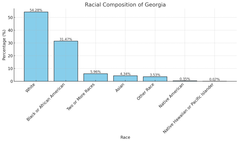
Racial Composition of Georgia (Most Recent ACS Data)
Largest Cities
Fulton County, with a population of approximately 1,084,512, remains Georgia’s most populous county, having grown by 1.41% since the last census. Other major counties with populations over 500,000 include Gwinnett, Cobb, and DeKalb, with Gwinnett experiencing the highest growth rate among them at 3.39% according to World Population Review. Taliaferro County is the least populated in Georgia, with around 1,610 residents and a 4.4% decline since the previous census. Other counties with fewer than 5,000 residents include Quitman, Webster, Clay, Glascock, Baker, and Echols, most of which have seen population declines since 2010. Long County has experienced the most significant growth in Georgia, with a 27.8% increase since the last census. Forsyth and Jackson counties also saw notable growth, both exceeding 20%.Counties of Georgia
Fulton County
Gwinnett County
Cobb County
DeKalb County
Chatham County
Clayton County
Cherokee County
Forsyth County
Henry County
Hall County
Richmond County
Muscogee County
Paulding County
Houston County
Columbia County
Coweta County
Bibb County
Douglas County
Clarke County
Carroll County
Fayette County
Newton County
Lowndes County
Bartow County
Walton County
Whitfield County
Floyd County
Rockdale County
Barrow County
Jackson County
Glynn County
Bulloch County
Dougherty County
Effingham County
Troup County
Spalding County
Liberty County
Walker County
Catoosa County
Gordon County
Camden County
Bryan County
Laurens County
Habersham County
Colquitt County
Thomas County
Polk County
Oconee County
Coffee County
Baldwin County
Tift County
Murray County
Pickens County
Harris County
Ware County
Lumpkin County
Lee County
Gilmer County
Dawson County
Madison County
Haralson County
Wayne County
Monroe County
Jones County
White County
Decatur County
Peach County
Sumter County
Upson County
Hart County
Union County
Stephens County
Toombs County
Butts County
Fannin County
Grady County
Chattooga County
Franklin County
Tattnall County
Burke County
Putnam County
Emanuel County
McDuffie County
Morgan County
Greene County
Lamar County
Mitchell County
Meriwether County
Pike County
Long County
Pierce County
Banks County
Elbert County
Worth County
Washington County
Dodge County
Crisp County
Berrien County
Brantley County
Appling County
Cook County
Rabun County
Ben Hill County
Jasper County
Dade County
Brooks County
Oglethorpe County
Jefferson County
Jeff Davis County
Screven County
Towns County
Charlton County
Bleckley County
Crawford County
Heard County
Macon County
McIntosh County
Dooly County
Candler County
Bacon County
Evans County
Lanier County
Early County
Pulaski County
Wilkes County
Telfair County
Johnson County
Irwin County
Seminole County
Terrell County
Jenkins County
Chattahoochee County
Atkinson County
Lincoln County
Taylor County
Twiggs County
Marion County
Wheeler County
Clinch County
Treutlen County
Randolph County
Miller County
Talbot County
Calhoun County
Warren County
Stewart County
Schley County
Echols County
Glascock County
Clay County
Baker County
Webster County
Quitman County
Taliaferro County
Major Airports in Georgia